
Projects
IAH Karst Commission members are involved in a great variety of project around the world. Here are some highlights of a few of the projects with significant involvement of the commission.
KaMERaMAN
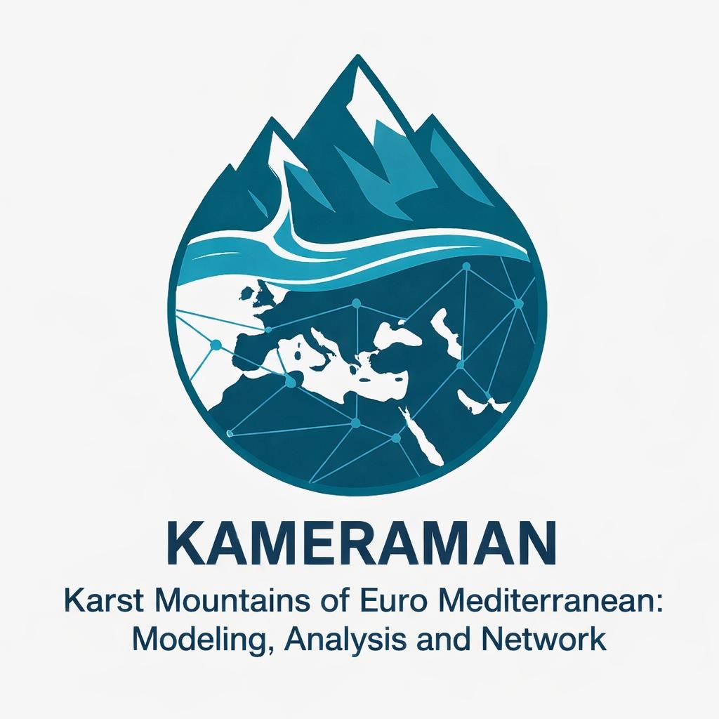 The KaMERaMAN initiative is a collaborative, multi-phase project focused on addressing the hydrological vulnerability of mountain karst aquifers across the Euro-Mediterranean region—a critical climate change hotspot. Characterized by complex, heterogeneous recharge and rapid preferential flow paths, these mountainous “water towers” face significant threats from rising temperatures, shifting precipitation regimes, and declining snow cover.
To support robust, climate-resilient water resources management in the karst mountains of the Euro-Mediterranean covering the Atlas, Betics, Pyrenees, Apennines, Alps, Jura Mts., Carpathians, Dinarides, Hellenides, Balkans, Taurus, Levant, and Zagros, the initiative actively unites researchers from 14 different countries (Albania, Algeria, Austria, Czech Republic, France, Germany, Greece, Iran, Israel, Italy, Morocco, Slovakia, Slovenia, and Turkey).
KaMERaMAN is systematically structured into three consecutive phases:
- Data Collection & Harmonization: Building a comprehensive, open-access database of high-resolution hydrometeorological and discharge time series across major Euro-Mediterranean mountain belts.
- Advanced Hydrological Modeling: Applying state-of-the-art conceptual and advanced computational modeling architectures tailored specifically to the complex non-linear dynamics of karst system responses.
- Regional Evaluations: Concluding with cross-regional vulnerability assessments to map future water availability and guide local and regional climate adaptation strategies.
Currently, the foundation of Phase 1 is established through a major data compilation effort featuring 118 high-resolution karst spring discharge time series specifically curated for hydrological modeling. The corresponding data paper is currently under review in Earth System Science Data (ESSD): Preprint DOI: 10.5194/essd-2026-281.
For further details, or to collaborate with the initiative, please contact Süleyman Selim Çallı (scalli@ankara.edu.tr).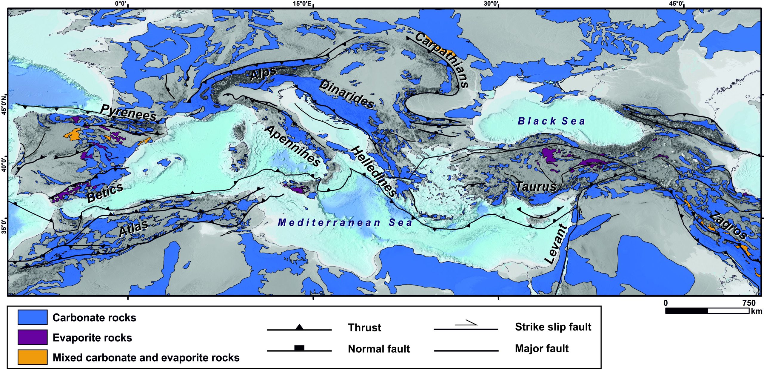
MIKAS Project
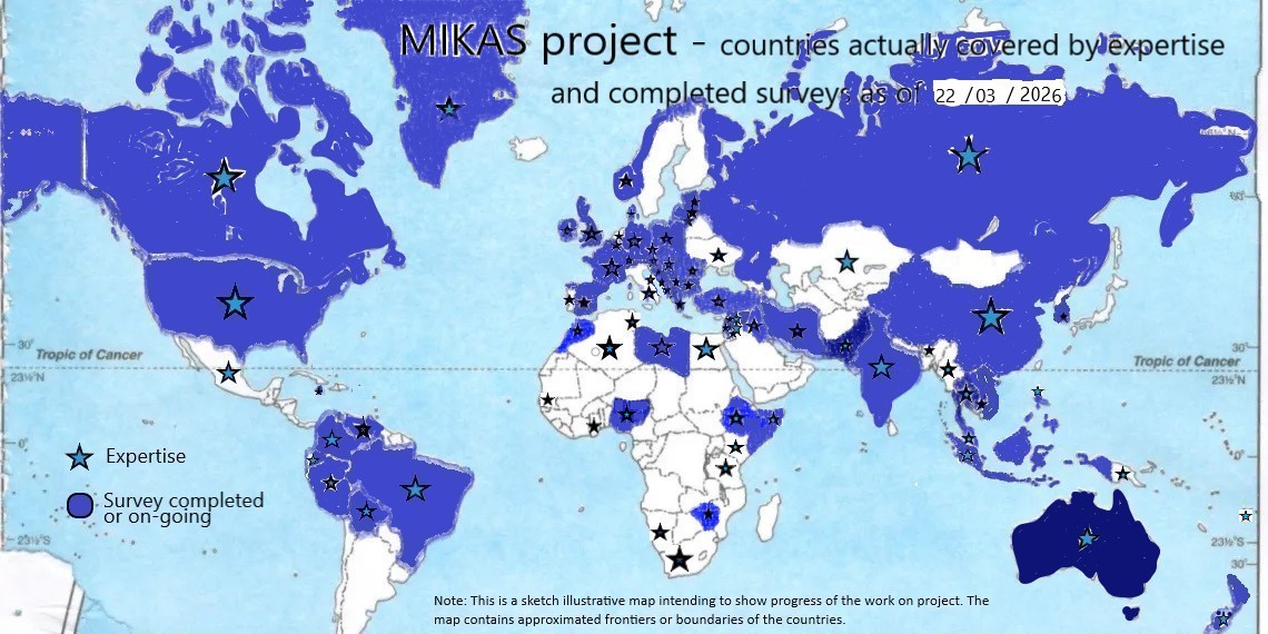 The IAH Karst Commission’s MIKAS project is advancing the identification and protection of the world’s most important karst springs. Launched in 2022, the project classifies springs of global importance under MIKAS and nationally important springs under NIKAS, using historical, aesthetic, economic, scientific and ecological criteria.
By the end of 2025, more than 100 national experts from six continents had assessed over 250 springs in 65 countries. More than 160 springs have already been included in the MIKAS group. Data collection will continue until September 2026, with coverage expected to reach approximately 80 countries. To mark the first celebration of the International Day of Caves and Karst on 13 September 2026, the first MIKAS information plaque will be unveiled at the Unica spring in Slovenia.
The project team is also preparing a Code of Practice to support sustainable water management and help protect listed springs from damaging interventions. The results will be presented in an open-access monograph, while new information and updates will continue to be published on the MIKAS project website.
More information on project status can be found at: https://mikasproject.org/
World Karst Aquifer Mapping Project (WOKAM)
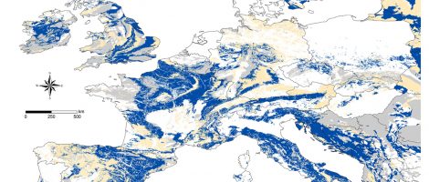
The World Karst Aquifer Map (WOKAM) is part of the World-wide Hydrogeological Mapping and Assessment Program (WHYMAP) to facilitate global water-resources management. The project started in 2012, with financial support from UNESCO-IHP and IAH, and the final map was published 2017. The team was led by Nico Goldscheider with an Scientific Advisory Board included KC members Augusto Auler, Michel Bakalowicz, David Drew, Zoran Stevanovic, George Veni and several other colleagues who are not KC members. Around 100 regional experts, many of them KC members, contributed to the success of the project by delivering data and existing maps from many regions of the world.
The mapping procedure and a draft map of Europe was published in a paper by Chen et al. (2017) and a global analysis of karst aquifers is published in a paper by Goldscheider et al. (2020). Both papers are “open access” and became “highly-cited papers” in the Web of Science:
Goldscheider N, Chen Z, Broda S, Auler AS, Bakalowicz M, Drew D, Hartmann J, Jiang G, Moosdorf N, Stevanovic Z, Veni G (2020) Global distribution of carbonate rocks and karst water resources. Hydrogeology Journal, 28(5), 1661-1677. https://doi.org/10.1007/s10040-020-02139-5
Chen Z, Auler AS, Bakalowicz M, Drew D, Griger F, Hartmann J, Jiang G, Moosdorf N, Richts A, Stevanovic Z, Veni G, Goldscheider N (2017) The World Karst Aquifer Mapping project: concept, mapping procedure and map of Europe. Hydrogeology Journal, 25(3): 771-785, https://doi.org/10.1007/s10040-016-1519-3
The map is available as Web GIS and for download in different data formats:
https://www.mags-projekt.de/whymap/EN/Maps_Data/Wokam/wokam_node_en.html
Karst Aquifer Resources availability and quality in the Mediterranean Area (KARMA)
The goal of the KARMA project is to progress in the hydrogeological understanding and sustainable management of karst groundwater resources in the Mediterranean area. Working across scales, from single springs to entire aquifer systems to the entire Mediterranean basin, KARMA aims to provide greater tools for water managers, including improved modeling tools and an early warning system for spring water contamination. KARMA test sites are located in Spain, France, Italy, Lebanon and Tunisia. These sites are also helping to develop a Mediterranean Karst Aquifer Map (MEDKAM), based on the existing WOKAM.
The project took place between 2019 and 2022. Many KC members contributed to the KARMA project, in different roles: The project is coordinated by Nico Goldscheider; Bartolomé Andreo, Hervé Jourde, Marco Petitta and Joanna Doummar contribute as PI; Zoran Stevanovic, Nataša Ravbar and Michel Bakalowicz act as external project advisors; and several other KC members are involved as Co-PI or regular project member.
The project has received funding from the European Union’s PRIMA research and innovation program and the national funding agencies. Further information can be found on this website: http://www.karma-project.org/
UNESCO project on Dinaric Karst Aquifer System (DIKTAS)
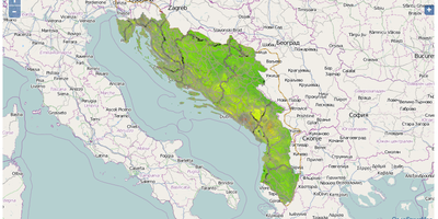
Karst Commission members are participating as experts on the Science Advisory Panel for the project “Protection and Sustainable Use of the Dinaric Karst Transboundary Aquifer System” (DIKTAS). This project was GEF funded and implemented by UNDP and UNESCO during the period 2011-2014. The project partners were the countries of Croatia, Bosnia & Herzegovina, Montenegro and Albania. The project’s mandate was to improve understanding of shared water resources and to facilitate their equitable and sustainable utilization, including the protection of dependent ecosystems. This was the first ever transboundary aquifer project of such a magnitude conducted in karst environment. The Project manager was our member Neno Kukuric, while Zoran Stevanović and Neven Kresic contributed or led some project activities.
After successful project completion, the second phase of the project: Improving groundwater governance and sustainability of related ecosystems is in preparation.
IGCP Project 598 – Environmental Change and Sustainability in Karst Systems
The aim of this project is to increase and improve global understanding of karst and water resources. Through this, the project hopes to educate people on the effects on ecological health and human issues related to water supply, agriculture, and urban development on karst (UNESCO/IUGS IGCP 598).
The KC Member Zhang Cheng is the project leader; KC members C. Groves, B. Andreo and Yuan Daoxian are among the co-leaders.
Karst Observatory–SNO KARST
A KARST observatory network (SNO KARST) has been initiated by researchers at the French Institut National des Sciences de l’Univers (INSU/CNRS). SNO KARST focused on strengthening knowledge-sharing and to promote cross-disciplinary research on karst systems at the national scale. Using a network of 9 observatories, the network aims to provide sustained long-term observations of key variables in karst waters and free, open-source analytical software for karst water researchers, covering a wide range of approaches. Visit the project site here: https://sokarst.org
World Karst Spring Databases (WoKaS and WoKaS-Iso)
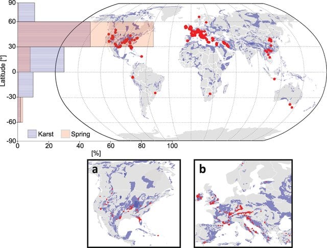 The World Karst Spring databases, WoKaS and WoKaS-Iso, are outcomes of a global community initiative aimed at improving data accessibility, collaboration and large-sample research in karst hydrology and cave science. Karst aquifers provide drinking water for a substantial share of the world’s population and support agriculture, ecosystems and groundwater-dependent activities. However, observations from karst systems have long remained scattered across publications, reports, national databases, online archives and individual research groups. The WoKaS initiative addresses this challenge by bringing together researchers from the international karst, cave science and isotope hydrology communities to compile, harmonize and make accessible global datasets for the study of karst groundwater systems. So far, the initiative successfully achieved the following objectives.
- First, the community compiled the World Karst Spring hydrograph database, WoKaS, the first global database of karst spring discharge observations. The dataset includes more than 400 spring hydrographs collected from scientific articles, hydrological databases and direct contributions from researchers worldwide, providing a valuable basis for comparative studies, trend analyses and hydrological model evaluation.
- Second, the initiative expanded this effort through WoKaS-Iso, the first extensive global compilation of oxygen-18 and deuterium isotope time series from karst springs and cave drip waters. The database integrates records from 236 springs and 74 caves, comprising nearly one thousand isotope time series from major karst regions around the world.
That way, the initiative improved the integration of hydrological and tracer-based information by combining spring discharge, cave drip water, precipitation, rainwater isotope data and stable isotope observations. This enables more comprehensive analyses of recharge processes, groundwater flow paths, storage dynamics, vadose zone processes and aquifer behaviour in karst systems. Altogether, WoKaS and WoKaS-Iso established open, community-based data resources that support large-scale comparative research, model development, process understanding and evidence-based groundwater management in karst regions.
Lead authors: Dr. Tunde Olarinoye for WoKaS and Yining Zang for WoKaS-Iso.
Scientific advisors: Prof. Andreas Hartmann and Dr. Pauline Treble.
Olarinoye, T., Gleeson, T., Marx, V. et al. Global karst springs hydrograph dataset for research and management of the world’s fastest-flowing groundwater. Sci Data 7, 59 (2020). https://doi.org/10.1038/s41597-019-0346-5 https://doi.org/10.1038/s41597-019-0346-5
Links: https://www.nature.com/articles/s41597-019-0346-5; https://essd.copernicus.org/preprints/essd-2025-812/
RObust Conceptualisation of KArst Transport– ROCKAT
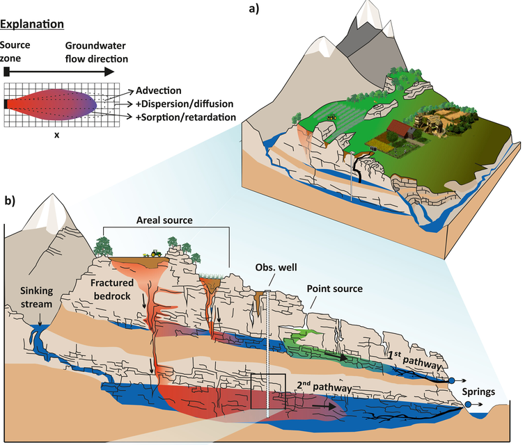 ROCKAT was a DFG-funded research project aimed at improving the understanding and modelling of flow and solute transport processes in karst aquifers. Karst aquifers provide drinking water for approximately 25% of the world’s population, yet their complex hydraulic structure makes reliable predictions of water quantity and quality particularly challenging. The project addressed this challenge by developing robust conceptual approaches that couple hydrological flow and solute transport processes across the main karst compartments, including the epikarst, matrix and conduit systems. The project successfully achieved four main objectives.
- First, novel methods were developed to derive continuous high-resolution major ion concentrations from electrical conductivity measurements, allowing a much more detailed characterization of transport processes in karst systems. These approaches were tested and validated in both hydrochemically homogeneous and heterogeneous karst catchments.
- Second, new conceptual modelling approaches for solute transport in karst aquifers were developed. Existing hydrological models were extended to include transport processes, leading to a coupled flow and reactive transport framework capable of reproducing both discharge and hydrochemical dynamics.
- Third, the project advanced multi-temporal and multi-objective calibration strategies using discrete wavelet decomposition. These methods demonstrated how hydrochemical observations, discharge data and age-related tracers can improve parameter estimation, reduce uncertainty and enhance process representation in karst models.
- Fourth, ROCKAT delivered LuKARS 3.0, a flexible, high-performance open-source modelling environment that enables efficient simulation of flow and transport processes, sensitivity analyses, uncertainty assessments and user-defined model structures within karst systems.
A key outcome of ROCKAT was the demonstration that hydrochemical information provides essential constraints for conceptual karst models and significantly improves the representation of internal flow and transport processes. The project also delivered an innovative coupled LuKARS–PHREEQC framework for simulating reactive solute transport in karst aquifers. The project resulted in numerous peer-reviewed publications, open-access datasets, international conference contributions and an openly available modelling platform that continues to be used in follow-up projects investigating climate change impacts, groundwater vulnerability and water quality in karst regions.
Project leaders: Prof. Gabriele Chiogna (Friedrich-Alexander-Universität Erlangen-Nürnberg) and Prof. Andreas Hartmann (Technische Universität Dresden).
Çallı, K. Ö., Chiogna, G., Bittner, D., Sivelle, V., Labat, D., Richieri, B., et al. (2025). Karst water resources in a changing world: Review of solute transport modeling approaches. Reviews of Geophysics, 63, e2023RG000811. https://doi.org/10.1029/2023RG000811
Funding: Deutsche Forschungsgemeinschaft (DFG), https://gepris.dfg.de/project/447437757?lang=en.
Effective and Realistic KArst Hydrological SIMulation and InfeRence (KASIMIR)
KASIMIR is a DFG-funded research project aimed at improving the realism, interpretability and reliability of hydrological modelling in karst aquifers. Karst aquifers provide water to approximately 25% of the world’s population, yet realistic and process-based simulations of karst spring discharge remain challenging due to the complex structure of karst systems and limited data availability. The project addresses this challenge by investigating how lumped karst models can be evaluated, constrained and related to physical system properties in order to enable more effective and realistic karst hydrological simulations. The project pursues four main objectives.
- First, KASIMIR investigates the realism of lumped hydrological models that are widely used to simulate karst spring discharge. These models are computationally efficient and commonly applied in practice, but their parameters are often difficult to interpret physically and may be affected by substantial uncertainty.
- Second, the project applies methods of uncertainty quantification, sensitivity analysis and model evaluation to identify which lumped model structures provide the most realistic representation of a given karst system. This helps to improve the reliability of model-based inferences about karst system properties.
- Third, KASIMIR establishes relationships between lumped model parameters and physical characteristics of karst systems. To achieve this, the project uses a large number of synthetic karst systems generated with stochastic karst conduit network generators in combination with spatially distributed process-based models.
- Fourth, the project simulates synthetic spring discharge time series that serve as known reference data. These controlled datasets make it possible to systematically analyse patterns in model realism, process representation and parameter relationships across many different karst system configurations.
A key aim of KASIMIR is to bridge the gap between efficient lumped modelling approaches and physically based representations of karst hydrological processes. By linking model parameters, model performance and physical system properties, the project contributes to a more robust interpretation of karst model results and supports the development of more realistic tools for karst water-resource assessment.
The project is expected to provide new insights into how model structure, parameter uncertainty and process representation influence the simulation of karst spring discharge. Its outcomes will support future applications in karst hydrological modelling, model evaluation, uncertainty analysis and groundwater management.
Project leaders: Prof. Andreas Hartmann and Dr.-Ing. Thomas Reimann
Funding: Deutsche Forschungsgemeinschaft (DFG), https://gepris.dfg.de/project/560588049?lang=en.
Tracer Group Initiative
This “Tracer Group” was initiated in 2022 under the umbrella of the Karst Commission during the Eurokarst in Malaga. It was shaped as a replicate, or rather an update, of the ATH association which was gathering all tracer scientists in the karst around the 90’s.
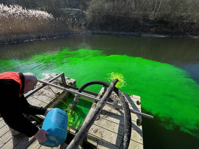
There is nowadays a growing demand (and exigence) for tests involving fluorescent tracers in water (especially when dealing with checking hydraulic connections) with the aim of reducing the hydro(geo)logical uncertainties, not only for karst research but also in a wider range of water applications and systems, like contamination hydrogeology, mining activities, geothermy, artificial recharge, fresh-seawater interactions or many other unexpected emerging scopes.
However, paradoxically, some uncertainties remain on the tracers themselves (their behaviour regarding the different applications cited) or the very variable methods, let us say preferences, among practitioners, not only in academic centers, but mainly among individual companies who put tracer tests in their toolbox.
The Tracer Group was thus created with the objective of reaching a more harmonized (thus more credible) understanding, dissemination and application of the fluorescent tracers in water. It is intended as well to wear a strong international (and teaching) component and must not be restricted to those “who know-or think- already”. A sounded scientific knowledge of the tracers is as much important as the return that users worldwide may bring. This even if a great deal of the knowledge on tracing techniques has been effectively coming from results in the field.
Another aspect which should be tackled through the Tracer Group is obviously the need for a consensual recognition of the tracer techniques, for which some situations may always be qualified as skeptical. A better communication regarding the tracers, the way they are used (including their limitations), or their sanitary doubts, seem necessary to allow their acceptation, and the eventual translation of their acceptance into guidelines or regulations.
Finally, especially since the community of tracer practionners will never reach the importance of some other hydrogeological tools (modelers for instance…), it would be preferable to speak about tracers to third parts with one unique voice and this probably begins with a higher insurance on the analytical techniques themselves (nowadays they are very composite and not standardized). The first action of the Group was precisely to assess the proficiency of these techniques in the laboratory and it demonstrated the need for other comparisons including the use of field fluorometers, or activated carbon detectors, as well as getting a better consensus on the nature/range of the tracers themselves.
The Group is open to anyone, in a volontary way, and an international contribution is fairly welcome. Those interested for a contribution are invited to notify their wishes to Philippe Meus (ewts(at)skynet.be). Thanks in advance for contributions!